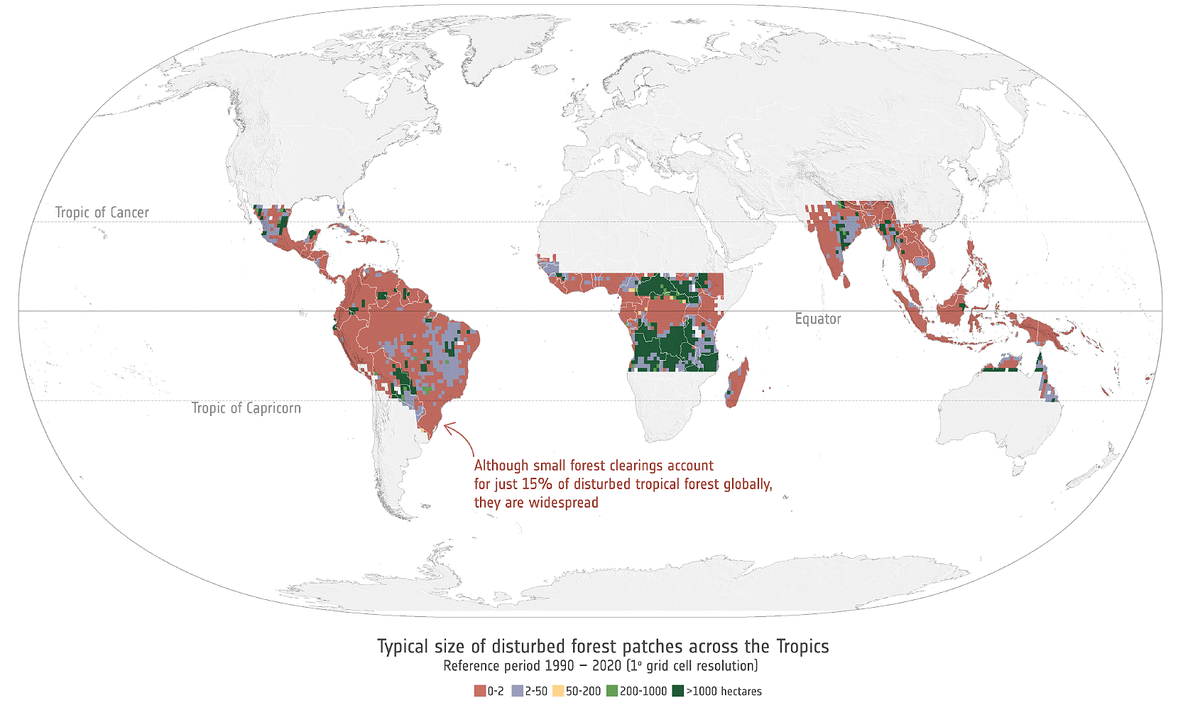
Small persistent humid forest clearings drive tropical forest biomass losses
We are pleased to have supported a recent study published in Nature, showing that smallest deforestation clearings, often less than two hectares, are responsible for more than half of total carbon losses. A cornerstone of the study are the European Space Agency’s CCI Biomass global maps produced by GAMMA Remote Sensing.
The combination of satellite SAR data by the Japanese Aerospace Exploration Agency and by the European Space Agency was fundamental: The CCI Biomass maps were used to reconstruct spatially explicit biomass-age recovery curves and to initialize a bookkeeping model, allowing to quantify the carbon loss or regain after each forst disturbance event. By anchoring this analysis to the biomass reference, the research team led by Yidi Xu at Laboratoire des Sciences du Climat et de l'Environnement was able to estimate the most spatially detailed picture to date of how tropical forest carbon has changed over the past 30 years.
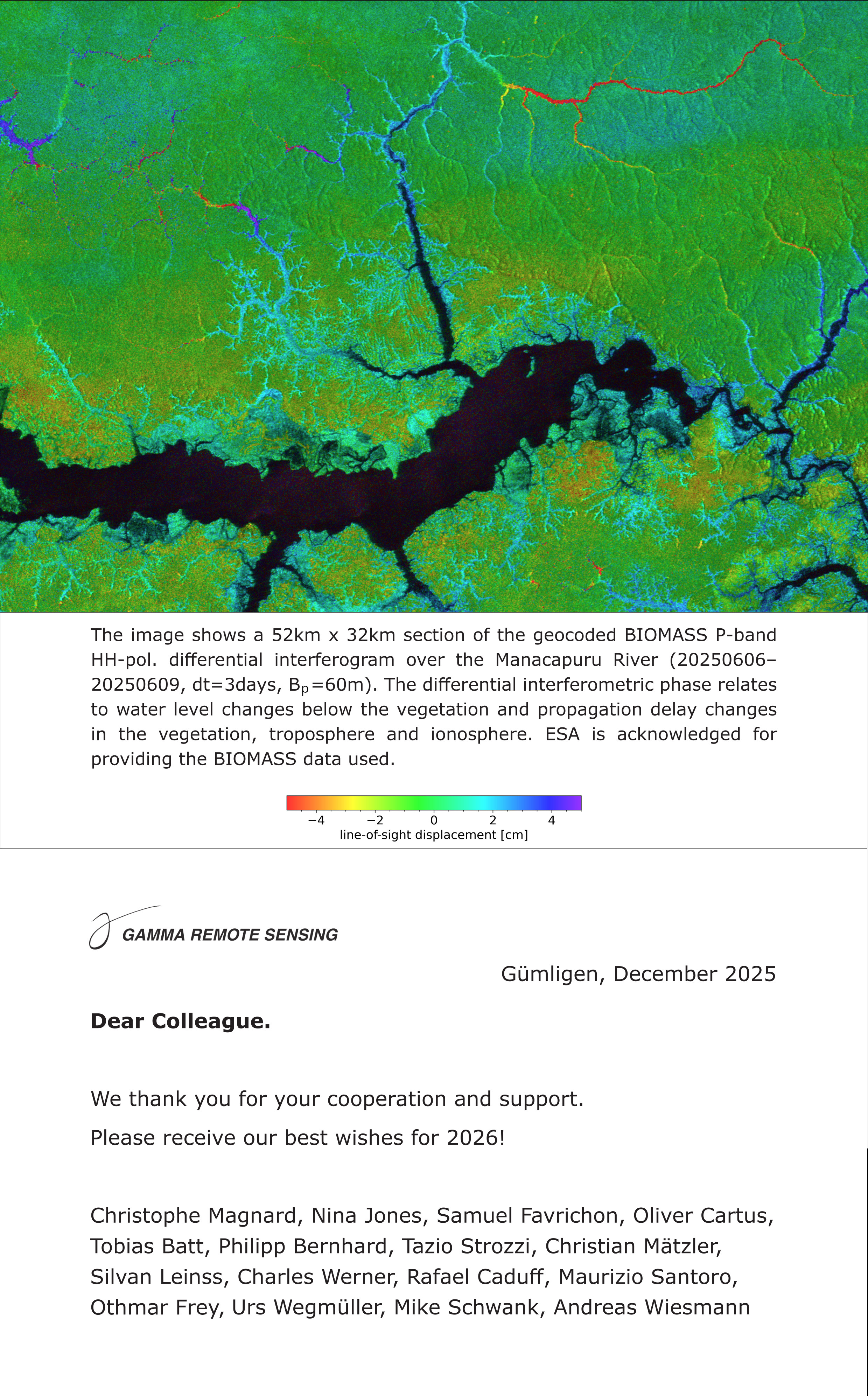
We thank you for your cooperation and support. Please receive our best wishes for 2026!
Earth Big Data LLC and Earth Big Data Germany GmbH and GAMMA Remote Sensing AG are joining forces in a strategic partnership (pdf).
We're collaborating to deliver cloud-based solutions for highly efficient SAR data processing. This means faster, more scalable insights for the remote sensing community.
Plus, we agreed on being authorized resellers of each other's flagship software: Earth Big Data’s SEPPO and the GAMMA Software. Get integrated access and combined expertise!
The Annual Report (pdf) on GAMMA activities in 2025 is now available.

The Annual Report 2024 (pdf) summarizing the GAMMA activities is now available for consultation.
JAXA announced the release of JERS-1 SAR global mosaic dataset Ver.2 processed by Gamma Remote Sensing. The dataset consists of yearly mosaics of the SAR backscatter between 1992 and 1998 and a single global mosaic.
The Annual Report 2023 (pdf) summarizing the GAMMA activities is now available for consultation.
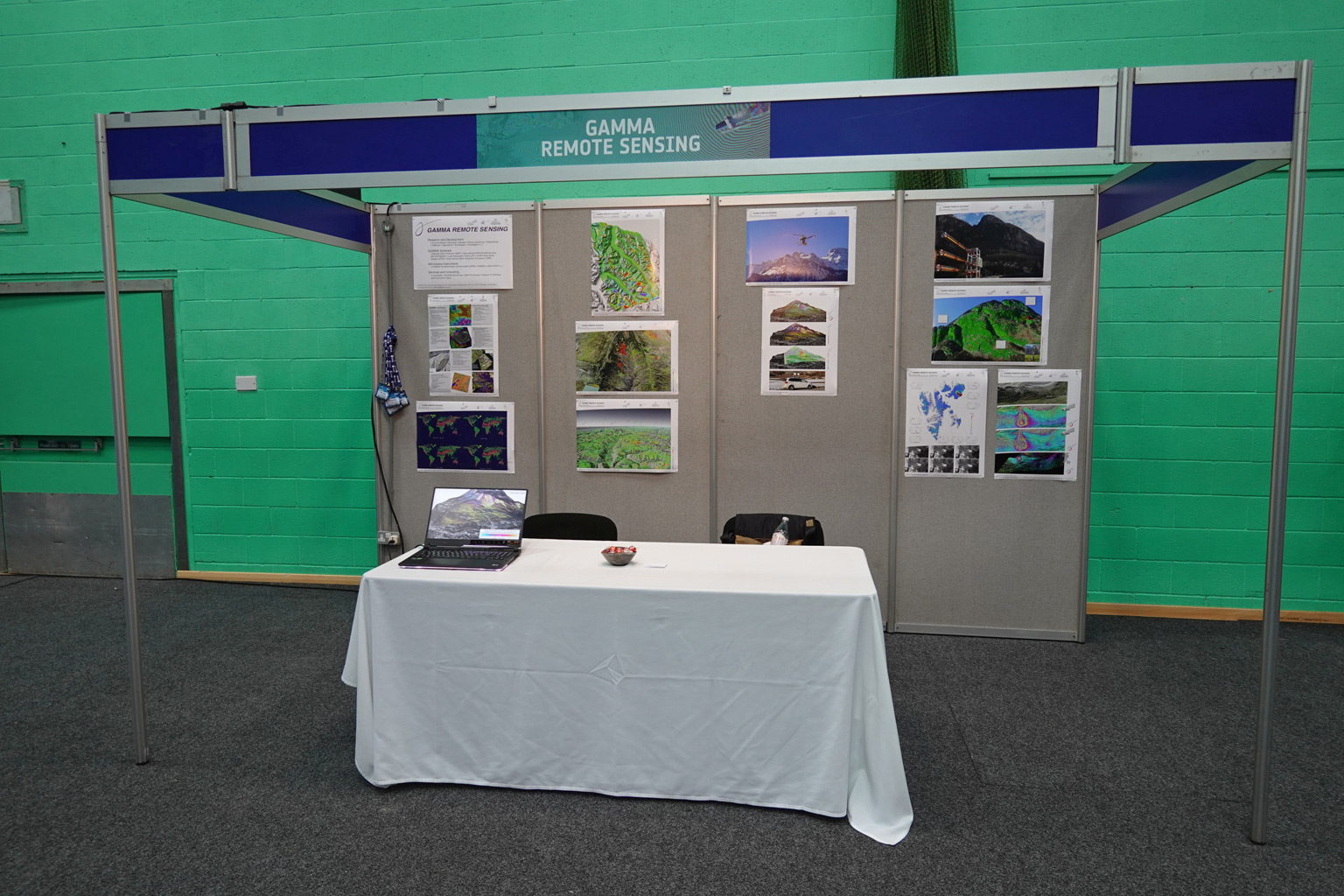
GAMMA was represented at the European Space Agency's FRINGE conference in Leeds, UK, in September 2023, and contributed with an exhibition booth, oral presentations and the following posters:
Obtaining Time-Series of Snow Water Equivalent in Alpine Snow by Ground-based DInSAR at 1-40 GHz
Seasonal Thaw Displacement in Low-Land Permafrost Areas at L-, C- and X-Band
SAR Tomographic Profiling of Seasonal Alpine Snow at L/S/C-, X/Ku- and Ka-Band
Pulse-to-pulse Interferometry to Map Velocity Fields with GAMMA Portable Radar Interferometer (GPRI)
The Annual Report 2022 (pdf) summarizing the GAMMA activities is now available for consultation.
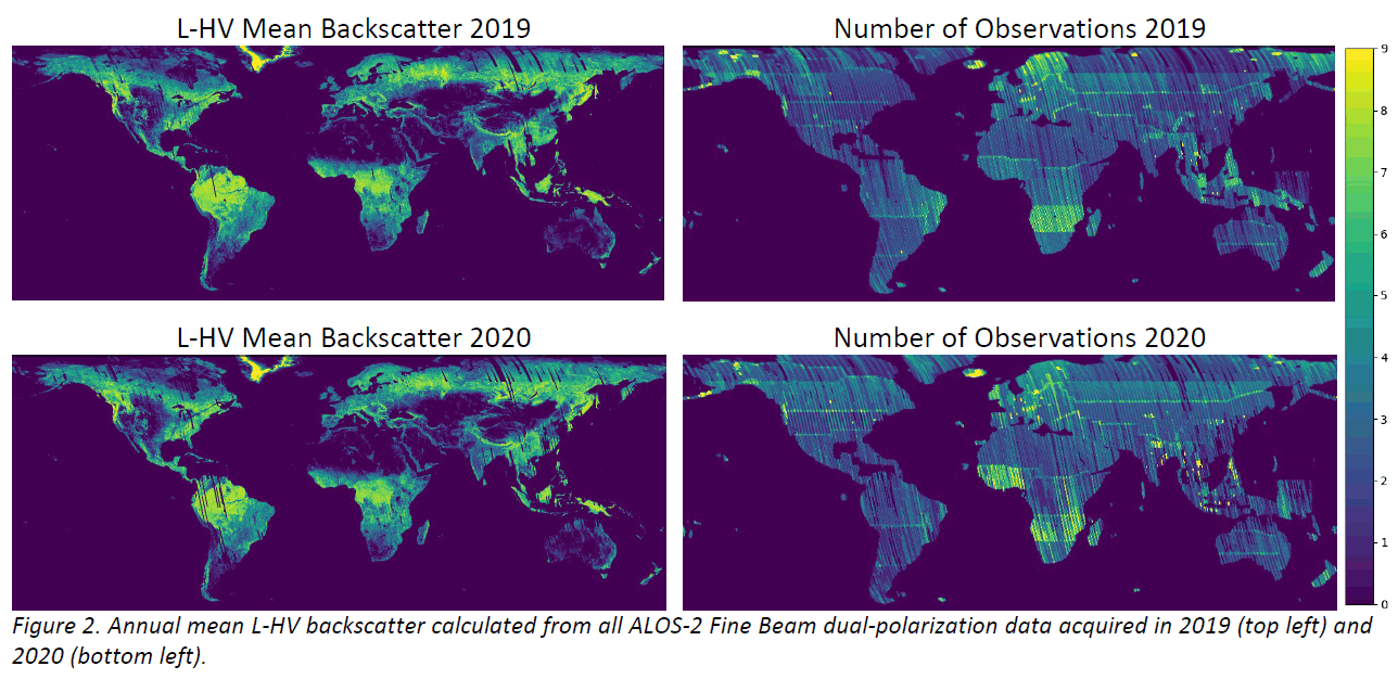
At the ALOS Joint PI Meeting 2022, GAMMA presented the status of a global processing effort in which all ALOS-2 Fine-Beam Dual-Polarisation L-band images acquired since the launch of the mission are processed to radiometrically terrain-corrected level. The resulting database of ALOS-2 L-band SAR imagery will support the mapping of forest above-ground biomass in the ESA CCI Biomass project. The presented poster can be downloaded here.
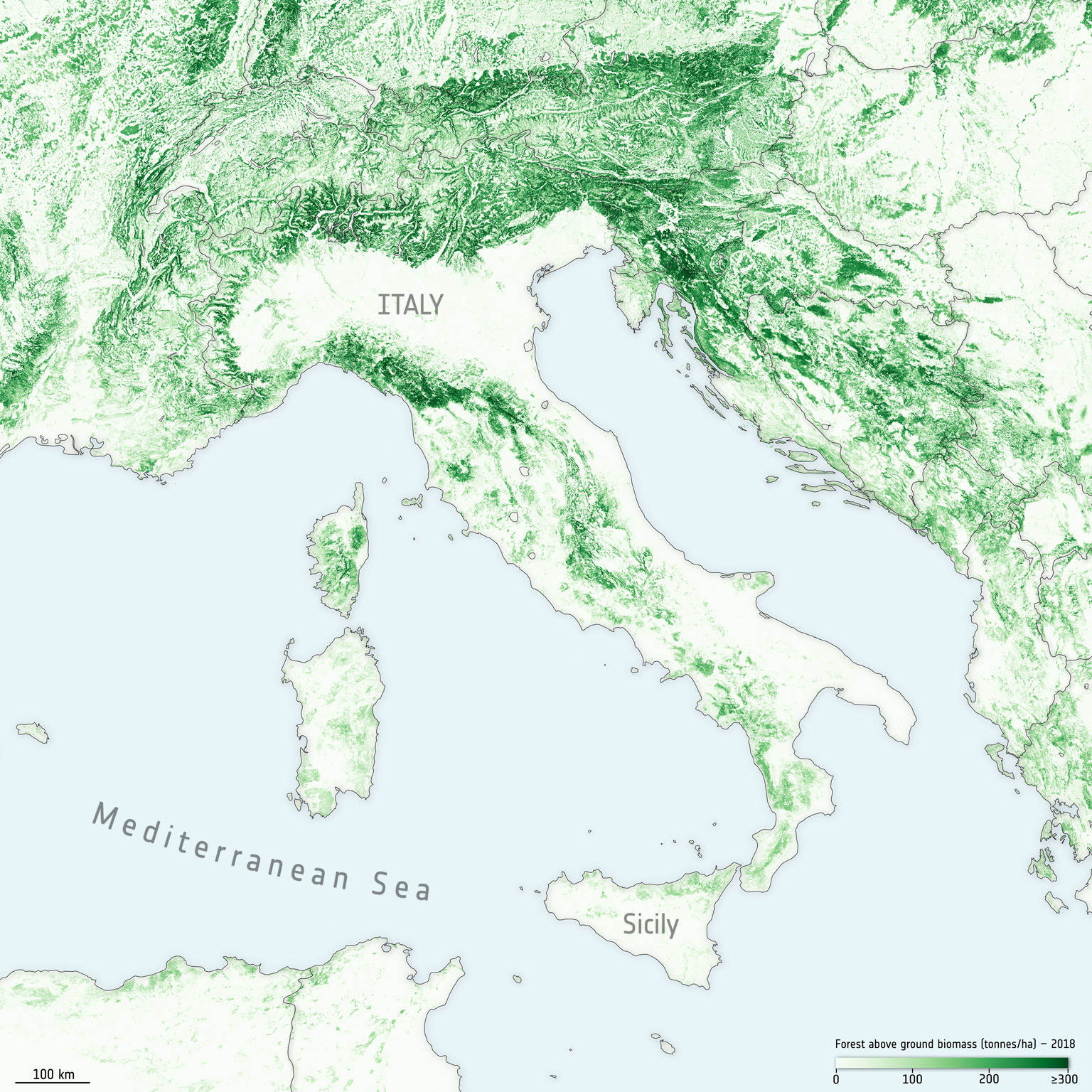
To draw attention to the international forest day, the European Space Agency gathered opinions from scientists of Gamma Remote Sensing and the Wageningen University that monitor forests with Sentinel data.
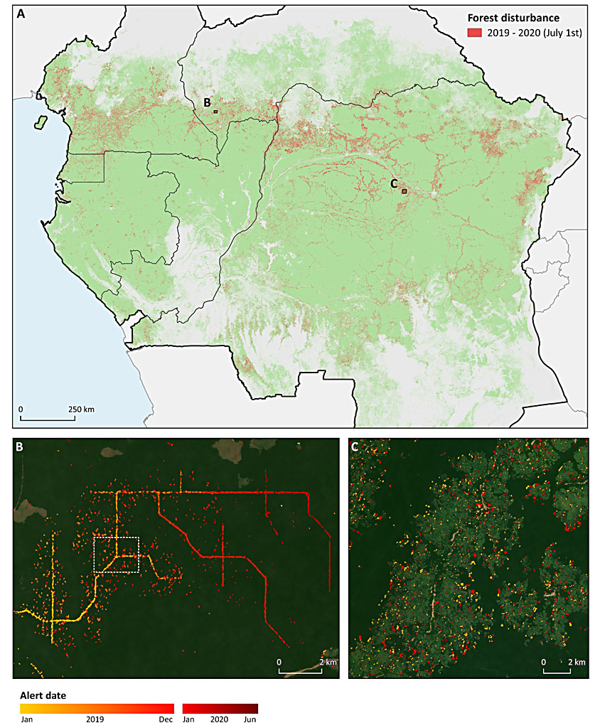
A Sentinel Success Story highlights the importance of Sentinel-1 global and repeated observations to map deforestation and the evolution of biomass: a breakthrough primarily in tropical regions where cloud cover does not allow for frequent observations with optical sensors.
Read the Sentinel Success Story at this link.
The Annual Report 2021 (pdf) summarizing the GAMMA activities is now available for consultation.
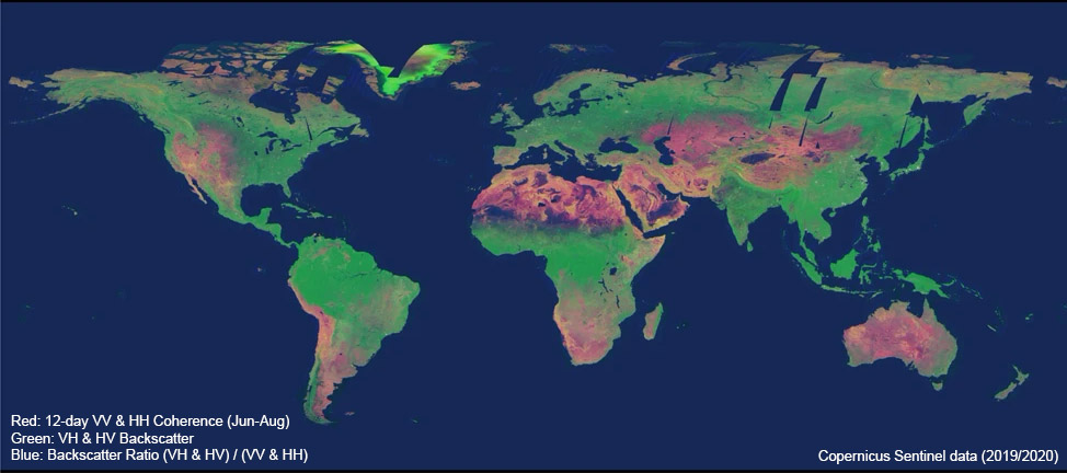
In a NASA/JPL-funded project, GAMMA Remote Sensing AG and Earth Big Data LLC have produced a global data set of Sentinel-1 coherence as well as backscatter. The data set, produced from 205000 Sentinel-1 Interferometric Wide Swath mode SLCs acquired between December 2019 and November 2020, comprises seasonal mosaics of the interferometric repeat pass coherence at repeat intervals of 6 to 48 days as well as backscatter at a spatial resolution of 3 arcseconds. The data can now be downloaded free of charge via the AWS Registry of Open Data.
The project results have been presented at the 2021 ESA Fringe Workshop.
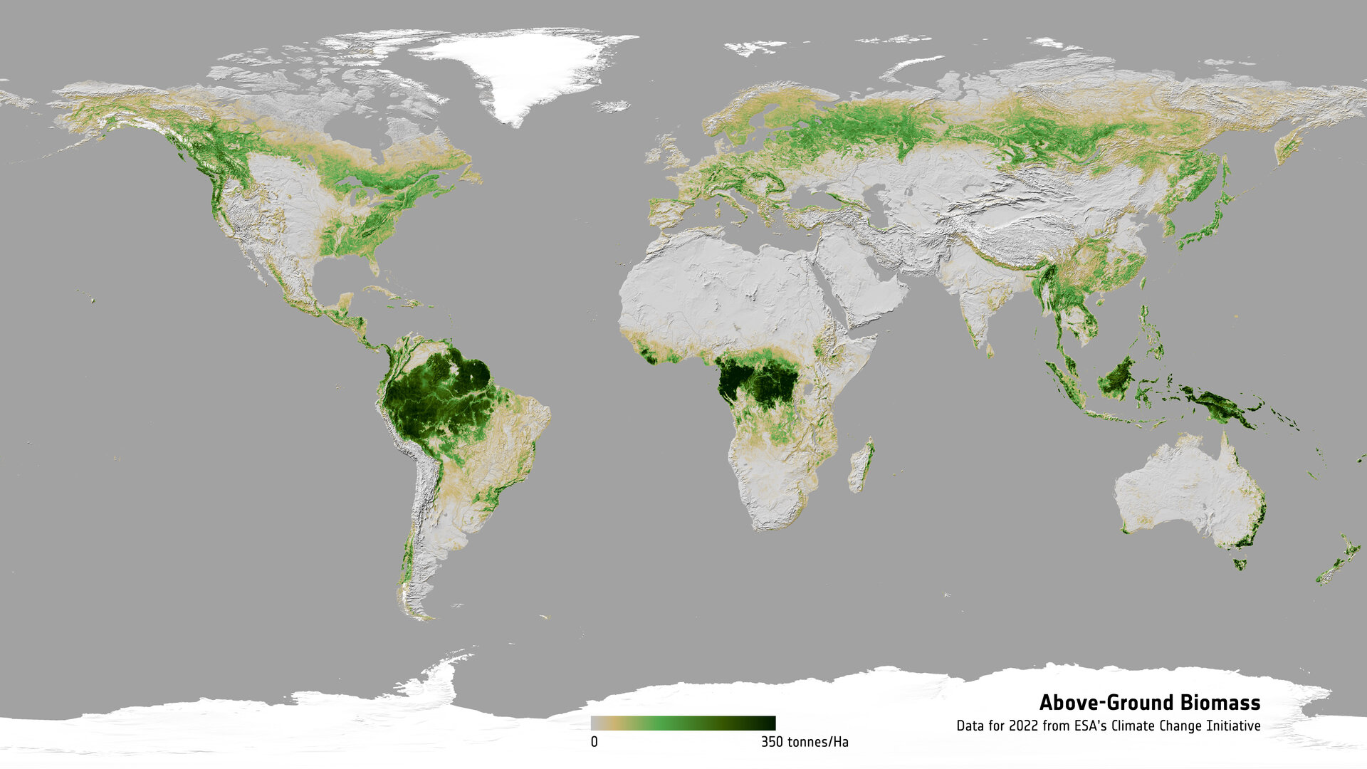
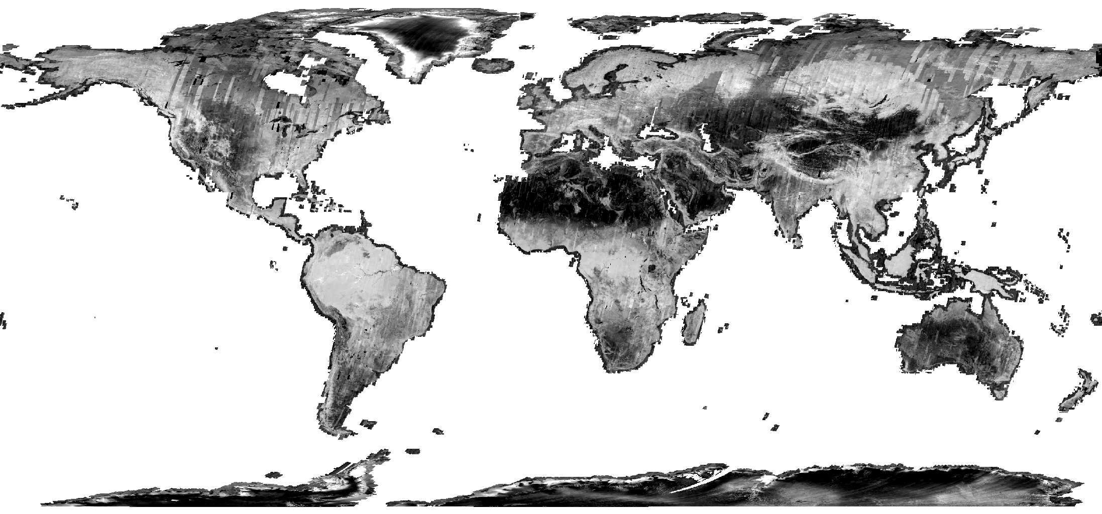
The terrestrial forest carbon pool is poorly quantified, in particular in regions with low forest inventory capacity. By combining multiple satellite observations of synthetic aperture radar (SAR) backscatter around the year 2010, we generated a global, spatially explicit dataset of above-ground live biomass (AGB; dry mass) stored in forests with a spatial resolution of 1 ha...
The full paper can be found at this link.
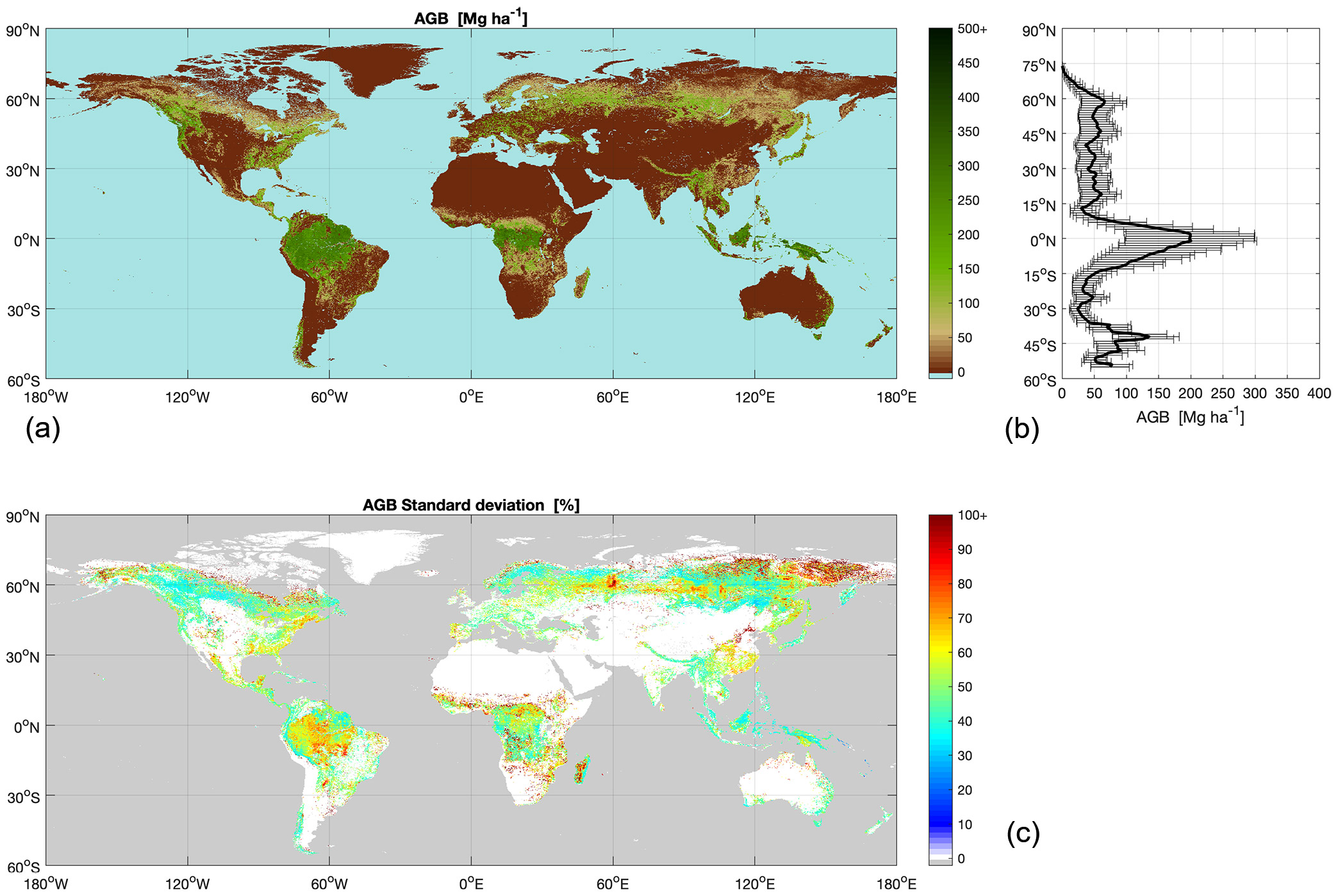
New maps, generated by a research team working as part of ESA’s Climate Change Initiative (CCI) provide a global view of above ground biomass distribution. GAMMA is responsible for the mapping algorithms, system development and map production.
The full press release from ESA can be found at this link.
For more information about the ESA CCI project and/or the activities carried out by GAMMA please contact Maurizio Santoro.
The Annual Report 2020 (pdf) summarizing the GAMMA activities is now available for consultation.
We have now added a new sections including videos of recent presentations delivered at international conferences. Check the link here below.

Dear customers and partners
Due to the SARS-CoV-2 outbreak it might be that we are not always reachable by phone during office hours. Please contact us by e-mail. If you have no contact within GAMMA yet please use our general This email address is being protected from spambots. You need JavaScript enabled to view it.. We thank you for your understanding. Stay healthy!
GAMMA Remote Sensing AG
The Annual Report 2019 (pdf) summarizing the GAMMA activities is now available for consultation.
GAMMA, SATIM (www.satim.pl) and ICEYE Polska started the 3-years EUROSTARS E!113220 Project RAMON: INNOVATIVE RADAR-BASED SERVICE FOR NEAR REAL-TIME LANDSLIDES MONITORING. We design, develop and test an innovative radar-based landslides monitoring service to support different phases of the landslide risk management. The service combines existing, established elements as landslide velocity maps derived from stacks of satellite SAR data using Persistent Scatterer Interferometry with new near-real-time monitoring elements, as urgently required during crisis situations, made possible using a novel microsatellite constellation and terrestrial radars.
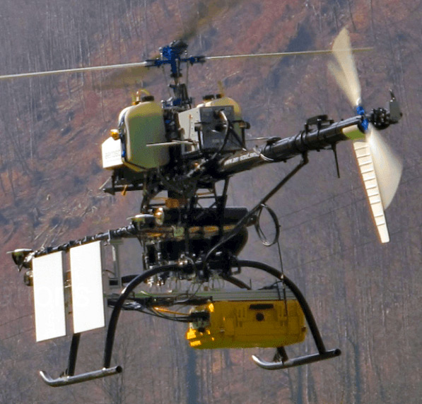
In fall 2018 and winter 2019, we have conducted synthetic aperture radar (SAR) campaigns demonstrating the feasibility of measuring surface displacements by means of UAV-borne and car-borne repeat-pass interferometry using the novel GAMMA L-band SAR system, a compact FMCW SAR system (weight: 7.65 kg) with up to 4 simultaneous receive channels and one or two (alternating) transmit channels supporting various interferometric as well as fully-polarimetric acquisition modes. The VTOL UAV used for the airborne SAR acquisitions is the Scout B1-100 developed and operated by Aeroscout GmbH. The car-borne SAR project is in collaboration with ETH Zurich, supported by Innosuisse - Swiss Innovation Agency. Please check the documents below for more information.